Sand Lake

SAND LAKE
GPS: 44.52730N, -084.55811W


My personal favorite! Sand Lake is located east of Mancelona, just off C38. Turn south on Sand Lake Road. This beauty is snuggled deep in the woods at the end of an unimproved road. Thousands drive past, not aware of its existence.

Sand Lake is a beautiful, peaceful area to escape and spend a few hours relaxing. Walk around the lake, or lay under a tree for an afternoon nap. Sand Lake
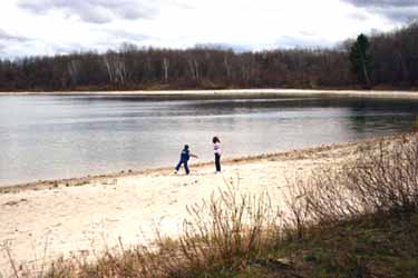
In May, keep your eyes open as you make your way to the lake. Morel mushrooms can be found in this area. During berry season, the blackberries and blueberries can enhance your visit to beautiful Sand Lake.

Jordan Valley

JORDAN RIVER VALLEY AND PINNEY BRIDGE

GPS: (Bridge) 45.00845N, -085.01804W

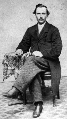
Curtis Sherwood Pinney around 1870Mother Nature fit a whole lot of beauty here!
 

Several dirt roads wind through scenic Jordan River Valley, with the main one running for US 131 to M-66. Start on US 131 one mile north of Deadman's Hill Road. This fifteen mile scenic road parallels the Jordan River from its headwaters along its path through the valley to Pinney Bridge, at which point the road continues west, to exit at Highway M-66.


According to documents prepared by Allison Beebe Pinney, Pinney Bridge was named after his father, Curtis Sherwood Pinney. An original homesteader in the Jordan River Valley, Curtis Pinney fought in the Civil War as part of the 154th NY Volunteers and received a land patent for 160 acres in Section 34, just Northeast of the Pinney Bridge. Curtis had done some chopping down of big trees to prepare a place to build a log house the following spring.  The home would be for the Pinney Family (Curtis, his wife Marian, Allison and his brothers Howard and Herman, his sister Laura, and their Grandmother Pinney.


The Pinneys got off the train about four miles north of the present town of Alba (the location was known as Simons). Their homestead was about five and one half miles west. A trail or woods road connected the two locations. Settlers crossed the river on a pole bridge a few miles down the river from Deadman's Hill. The bridge became known as "Pinney Bridge," after the Curtis Sherwood family.


Often mis-spelled as "Penney Bridge," descendants of Pinney were successful in getting a road sign on Highway M-66 corrected to read "Pinney Bridge."

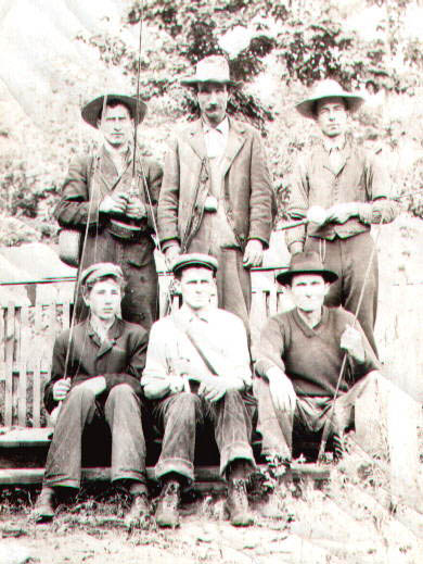
Seasonally, the area provides fishing, berry picking and morel mushrooming. Your visit to the valley could easily be made into a day trip, depending on how often you Pinney_Fishermen_Photoget out of the car to explore. Be sure to include stops at the Fish Hatchery and Deadman's Hill.
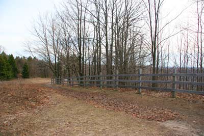
Consult your local Antrim County map for the location of Marsh and Cascade Roads. Enjoy the waterfalls along Cascade Road. Jordan River Valley is accessible by car spring through fall. The area is a haven for snowmobiles in the winter.

Along the seasonal Jordan River Road, you'll see an entrance to the Jordan River National Fish Hatchery, which is accessible by snowmobile in winter. The hatchery leaves its doors open 24 hours a day, 7 days a week, for snowmobilers to use restrooms. The coffee pot is always on!


Photos: (L) Curtis Sherwood Pinney.  (R) Pinney's sons, nephews and grandson heading out on a fishing trip in the Jordan River.  Photos provided by Gary Byar, a descendant of Pinney. This account was written by Allison Pinney.

This back entrance is also open to vehicular traffic seasonally. (Another article on this Website provides details on the Jordan River National Fish Hatchery)


Deadman's Hill

DEADMAN'S HILL OVERLOOK -
GPS: 45.02782N, -084.56309W (this is incorrect; we will update)
 

Deadman's Hill late fallThe period of early logging in the hills of the Jordan River Valley were marred by several fatal accidents.

Read more …